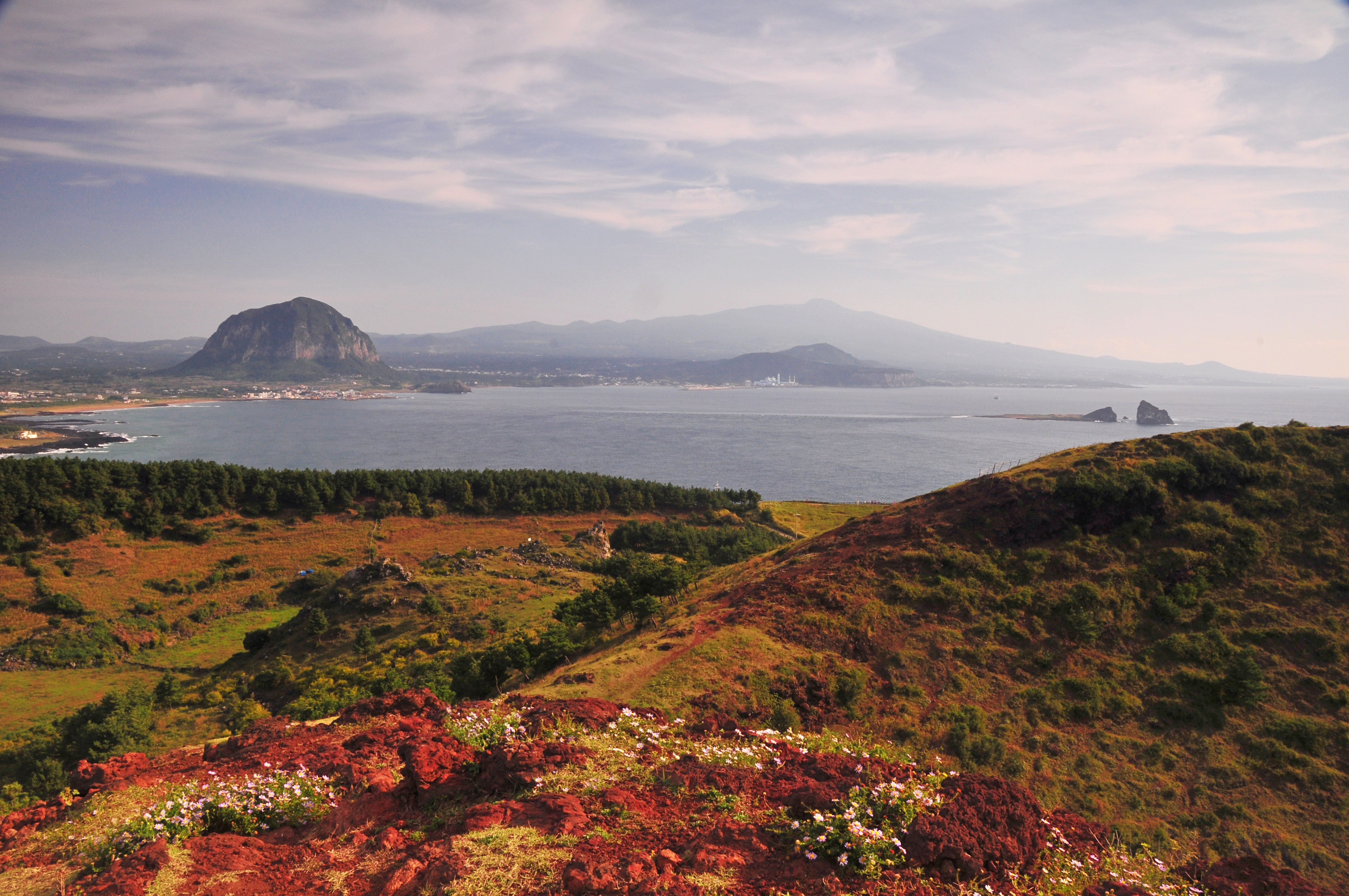
Sanbangsan Mountain
 Copyright © JEJU TOURISM ORGANIZATION
|
Introduction |
|
Sanbangsan
Mountain is the result of violent volcanic activity some 700,000 to 800,000
years ago and is in fact a huge body of lava. The cliffs on the southern side
of the lava dome are marked with a rich variety of curious formations such as
weathering pits and talus scree slopes, some of
which are as high as 200m. As its name ‘sanbang’ –
literally meaning ‘a cave inside a mountain’ – suggests, this mountain
contains a cave, which is located about 150m above sea level and has a
spectacular view out over the ocean. Due to its close location to the sea and
its high elevation, the peak is often ringed with clouds. The upper slopes of
the mountain have their own distinct climatic conditions and are protected
for their value for botanical research.
More: http://www.visitkorea.or.kr/enu/SI/SI_EN_3_1_1_1.jsp?cid=778953 |
Articles
-
 Marado Island
-
 Sunrise at Seopjikoji
-
 Saraoreum Lake
-
 Suwolbong Peak
-
 Beautiful View of Sunrise at Seongsan Ilchulbong Peak
-
 Cloud Enshrouded Seongsan Ilchulbong Peak
-
 Along Seongsan Ilchulbong Peak
-
 Seongsan Ilchulbong Peak
-
 On the Way to Hallasan National Park
-
 Wind Generators
-
 Gotjawal Forest
-
 Sanbangsan Mountain
-
 Bijarim Forest
-
 Night View of Yongyeon Cloud Bridge
-
 Cheonjiyeon Falls Promenade
-
 Blooming Sunflowers at Myeongdoam
-
 Yongcheondonggul Cave
-
 Gimnyeong Beach
-
 What Koreans First Imagine When Jeju Comes to Mind
-
 Shamanism
-
 Shamanism